| Home | | | Bio | | | Gallery | | | Events | | | Blog | | | Guestbook | | | Mailing List | | | Links | | | Contact |
Blog
(posted on 5 Mar 2012)
I'm finally back on-line in Australia after a glorious month in New Zealand. Sorry for the delay in posting but we were having such fun that it was next to impossible for us to stop, take time to find an internet connection that worked, and had any speed in uploading photos. So I'll have to make it up to you today.
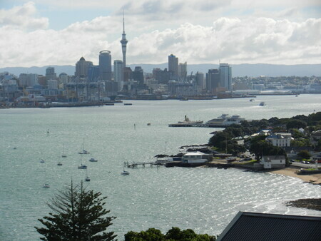
We started in beautiful Auckland, and spend a few days climbing various volcanos around the city. Little did we know that that was the start of a theme for not only February, but the year. We climbed at least 6 volcanos, saw a lot more, and of course will be attempting to summit a VERY large volcano, Mt. Kilimanjero, in Africa in May!
But, back to Auckland. What a great city--cosmopolitan, historic, well modernized, and yet very friendly. We were at the base of Mt. Eden, the tallest of the volcanos in the Auckland area, looking at our street map and trying to figure out how to get back to our hotel, when a passing car actually stopped, turned around and pulled over. The fellow jumped out and ran over to help us, saying he'd noticed us looking at our map and wanted to know if we needed help. When was the last time that EVER happened to you, let alone in the biggest city in a country? Very refreshing, I must say.
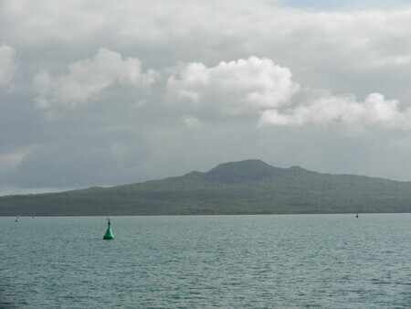
Rangitoto Island is the newest volcanic peak (about 200 years old) in the area and we took a boat across the harbour to climb it. It was probably the warmest day we had there and I was happy to have a quick swim in Auckland harbour once we got back down, and were waiting for the ferry to take us on to Devonport and North Head (yet another volcano). That was the last swim I had for a while--until I had to demonstrate my true Canadianhood in the cold stream waters of the South Island on our 6 day hike!
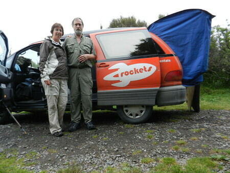
After 3 days in Auckland we picked up our little Rocket van named Mercury and hit the road south.
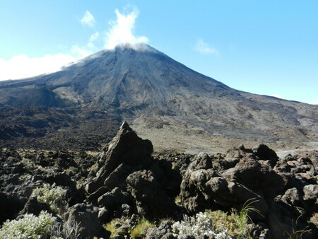
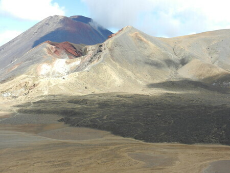
Waitomo Caves and glowworms were first, then we climbed some more volcanos including Mt. Egmont (aka Taranaki) and hiked the Tongiraro Alpine Crossing, known as one of the best one-day hikes in the world, and the best in NZ. It truly lived up to its reputation (although we had to wait about 3 days for the weather to improve enough for us to do it.
Mt. Taranaki below right
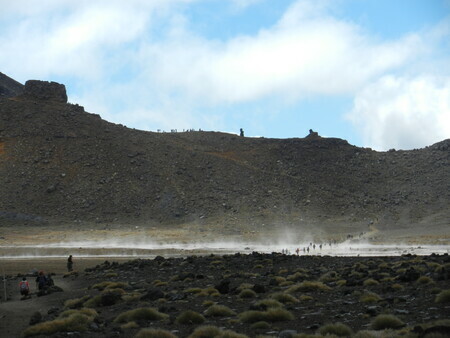
Steaming crater at Tongiraro
On the climb up to Tongiraro there is a great view of the lava chunks looking towards Mt. Ngauruhoe, an adjacent classic volcano peak.
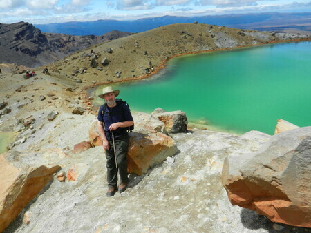
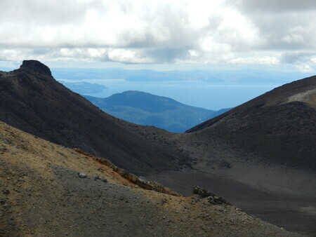
Looking down the ash slope towards Green Lakes
Just above the Green Lakes where we had our lunch. There was a steady trail of people doing the walk on this gorgeous day.
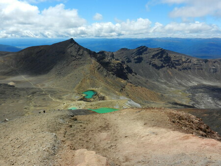
Looking back to the Red Crater (below Mt. Ngauruhue) across another crater.
Note the lava flow in middle foreground.
Lake Taupo seen from the north side of Mt.Tongiraro below.
Then it was down to the South Island for the rest of our travels. First stop, with some Canadian friends, was Cloudy Bay--a noted wine area with lots of beauty of its own. We stayed at a DOC (government) campground at White's Bay--a gorgeous spot which evey had showers (albeit cold)--a step above most of the minimally serviced campgrounds we stayed at. Every few days we stayed at a proper caravan park so we could shower, do laundry, and cook on a real stove, as well as get some water bottles frozen to keep our "chilly bag" (esky/cooler) cool for a few more days. We were very impressed with the range of campgrounds as well as the number--it seems like it's really the thing to do to see New Zealand. Some roads (particularly on the South Island) all we saw were campervans. No local cars, no trucks, no buses except tourist buses. If it wasn't for tourists, and agriculture--mostly sheep, cattle, and grapes--I'm not sure what the Kiwis would do for employment!
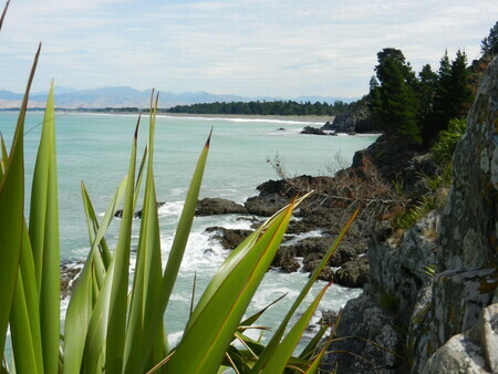 White's Bay looking towards Cloudy Bay
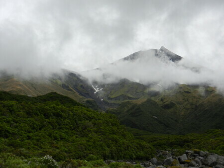
We enjoyed visiting some wineries before we decided the weather was good to head to the West Coast and some glaciers. So off we went to Hokitaki, then the Franz Josef and Fox glaciers, and south to Haast. Then we cut back inland through Wonoka, and hit Mount Cook for a night. Hubby wanted to see the tallest peak in New Zealand and we just managed to catch it peeking through the clouds that evening, before it started raining in the night.
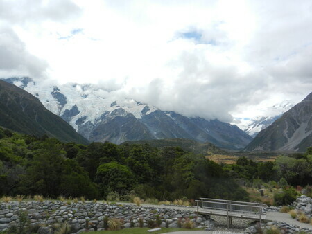 Mount Cook, hiding in the clouds (right) with "The Footstool showing well in front.
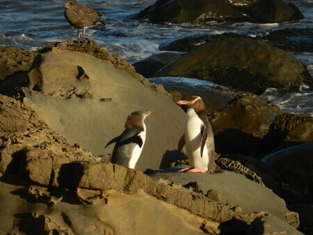
Once again we moved on through the rain to Dunedin to explore the south east coast of New Zealand. It was another historic town, and we decided to stay on the Otago Peninsula about 30 miinutes away. There we had a lovely evening viewing Dunedin harbour, penguins, albatross, and the next day the rain lifted enough to do some walking and see sea lions on a local beach. Fantastic!
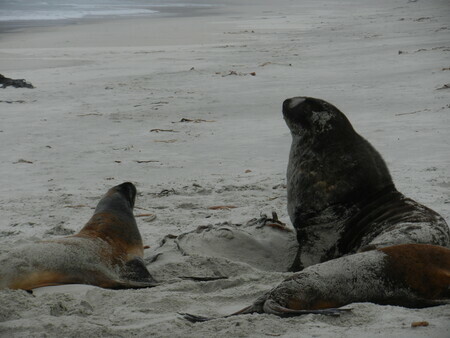
We then moved on to wilder territory, the Catlins on the far south coast, between Dunedin and Invercargill, for another beach camping night at a remote but lovely beach. Penguins AND sea lions on this beach, on our lovely evening walk.
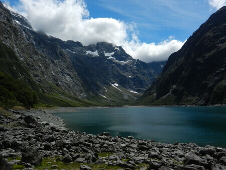
We then headed for Milford Sound, through Invercargill (which didn't seem to have much to recommend it), and camped for 2 nights north of Te Anau on the Milford Sound road, about 30 km short of Milford Sound itself. That was a great choice, as the scenery was lovely, the campsites by beautiful clear rivers were fantastic, and we had great access to Milford Sound (which was cloudy the day we were there) and a lovely hike to alpine Lake Marian which was sunny and quite like home to us British Columbians.
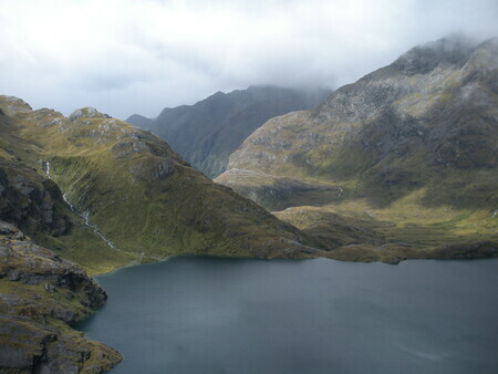
After that we headed for our final destination--Queenstown. We'd heard a lot about it but it still surprised us--beautiful, trendy and lively, too many bars and tourists for our liking--but a lot like a version of Whistler in the summer. We dropped off our van and had a nice night in a hotel before taking off for the Grand Traverse--the 6 day highlight of the month. It is composed of the Routeburn track (which is one of New Zealand's Great Walks and world-reknowned) plus the Greenstone Track which is a traditional track used by the Maoris to transport Greenstone (jade) from the coast to the interior. 88 km plus 3 optional climbs (we managed all of them) and we had great fun, met 14 lovely people, were well-guided and pampered with lodge accommodation including hot showers, drying rooms (necessary 2 nights, for rainy days) and beds and good meals. All we had to carry was our clothing and day's food and water, which is about the extent of my hiking I'd say. Good testing for our gear and clothing for Mount Kilimanjero, as well as our fitness. I think we passed! I felt lots stronger and only had to take painkillers one day! We all made it, and I think most of us are keen to do it again. There were a couple of return hikers on the trip--one Japanese fellow, 70, who was on his 4th time. Hiro told us that the Milford track was a picnic compared to this walk!
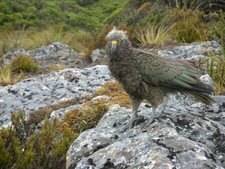
Kea (an alpine parrot)--smart as 5 year olds apparently. And some teens.
Looking across the Hollyford Valley
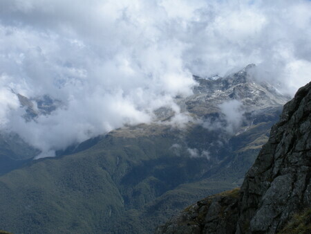
You could see all the way to the West Coast of New Zealand from the top of the Routeburn--from the top of the optional hike to Conical Peak
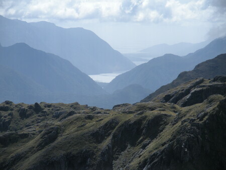
 Looking down into the Routeburn Valley...another 2 hours to the lodge.
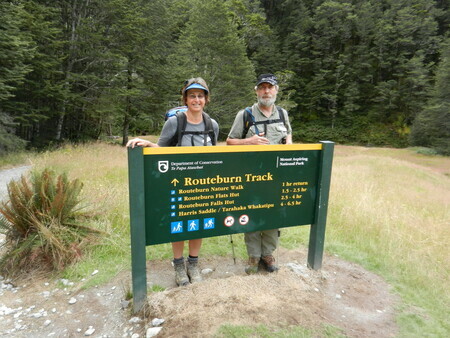 Finishing the Routeburn
After a last night in Queenstown, we caught our flights back to Sydney and have slowed down our travelling pace a little--although I still haven't had time to paint! I'll get my blog going a little more regularly--and will update you with our travels through Melbourne, South Australia and Tasmania the next time I write. I might put a few more photos up from the Routeburn when I get time too. Until then, sayonara!